

Parts of Accra shaken by earth tremor
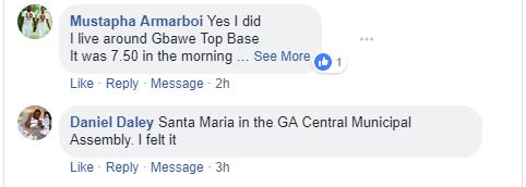
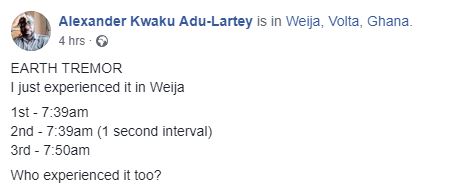
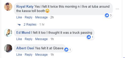
Residents living in and around Weija and Gbawe in the Ga South Municipality of the Greater Accra Region, on Sunday took to social media to share experiences of an earth tremor.
The tremor, which occurred at about 7:50 a.m. shook buildings, creating some panic among the residents.
Some residents who confirmed that they had felt the quake said they had no idea what it was.
Others said they didn’t realize it was an earth tremor until they saw many other people share their experiences on social media. It lasted for between three to five seconds.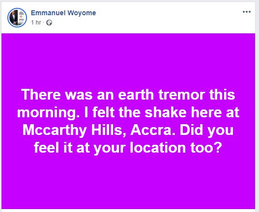
A Senior official of the Ghana Geological Survey Authority (GGSA), who confirmed the incident in a Citi News interview, said they are collecting data from other stations of the Authority to give definite details about what happened.
“There was an earth tremor this morning. One of the stations at GIMPA recorded this event so we can confirm that it was a small earthquake. For the magnitude, we have only one of our station’s data, but it tells us that the magnitude is not up to 5, it is somewhere a little above 4, so we are going to some of our other stations to retrieve data then we can have enough data, analyze it and give the exact magnitude and location of this earth tremor.”

A similar incident occurred in March 2018 with residents experiencing the tremor as many as three times within a day.
The Geological Survey Authority (GGSA) said it had picked information about the expected tremor days earlier because it realized that faulty lines in the affected areas were active.
Weija and Gbawe have long been known as earthquake-prone areas in the country.
A senior seismologist at the GGSA earlier this year told the Daily Graphic that there could be an earthquake in the country which was likely to be more severe than what was experienced in Accra in 1862 and 1939.
The fast-sprawling town of Kasoa in the Central Region and Gbawe in the Greater Accra Region share spoils with regards to the number of quakes.
The most recent, with a 5.9 magnitude and a 33-kilometre depth, occurred at 3 p.m. on September 26, 2007, 11 years ago, 385.2 kilometres from Takoradi, while 21 years ago at 3:16 p.m. on March 6, 1997, another one measuring 4.4 in magnitude and with a depth of 10 kilometres occurred 6.2 kilometres from Gbawe.
Gbawe was in the news again 28 years ago with two earthquake experiences.
The first, measuring 3.1 in magnitude and 10 kilometres in depth, occurred at 11:43 a.m. on April 14, 1990. 4.2 kilometres from the town, while the second, which measured 2.7 in magnitude and 10 kilometres in depth, occurred at 1:34 a.m. on February 12, 1990, 1.2 kilometres from the community.
In the last 31 years, Kasoa has also had its fair share of earthquakes — there was one measuring 2.0 in magnitude on March 23, 1989; 3.4 in magnitude on February 27, 1988 and 3.1 in magnitude on December 3, 1987, all 10 kilometres in depth.
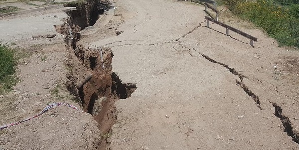
Danger looms as encroachers takeover mudslide-prone Weija Ridge
Meanwhile, a recent report byCiti News’ Ann Shirley Ziwu, revealed that some residents of Weija Ridge near the Kasoa Toll booth, are one downpour away from disaster, as the land on which they have built their homes, has been described as a mudslide area.
Locals continue to put up houses there even though it has been declared a danger zone. Residents have encroached on the land close to the Ridge, which is gradually being washed away anytime it rains.
The rocks fall off, and the land turns into a valley after every downpour.
source: citinewsroom